National Airspace System
The student should have an understanding of the national airspace system, and be able to apply it to a cross-country flight or sectional chart.
Elements
- airspace classes
- special-use airspace
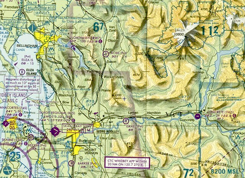
- chart appearance
Resources
- FAR/AIM
- Pilot's Handbook of Aeronautical Knowledge
- whiteboard and markers
- iPad with ForeFlight or laptop with FliteStar or access to skyvector
- Safety Quiz: Obstacle Clearance
Instructor actions
Using lecture and guided discussion techniques, introduce the student to the national airspace system and establish an understanding of the different types and restrictions. With a chart or FliteStar planning software, introduce unfamiliar areas and use the airspace to create scenarios.
Student actions
Read and complete the assigned homework; actively listen to the lecture and guided discussion, and participate in the scenario-based activity.
Completion Standards
The student should be able to identify various airspace, features, and the associated limitations with limited instructor guidance.
Teaching outline

- controlled vs uncontrolled
- atc service provided in controlled only
- with overlapping airspace, the more restrictive airspace applies
- VFR cruising altitudes
Controlled airspace
- Class A
- 18,000 - 60,000 ft msl
- contains all jetways
- IFR flights only
- must be cleared to enter
- mode c required
- Class B
- busiest airports, custom inverted wedding cake layout
- sfc - 10,000 ft msl, 20 nm radius in most cases
- must be cleared to enter
- VFR: 3 sm, clear of clouds
- mode c required (30 nm veil)
- pilot certificate or appropriate endorsements
- Class C
- congested airports, one-step inverted wedding cake
- sfc - 4,000 ft agl, 5 nm radius
- 1,200 - 4,000 ft agl, 10 nm radius
- two-way radio communication required to enter
- mode c required (30 nm veil)
- VFR: 3 sm, 500 ft below, 1,000 ft above, 2,000 ft horizontal
- Class D
- general airports
- sfc - 2,500 ft agl, 4 nm radius
- two-way radio communication required to enter
- VFR: 3 sm, 500 ft below, 1,000 ft above, 2,000 ft horizontal
- Class E
- all other controlled airspace
- starts at a variety of altitudes including the surface, with a limit of 18,000 ft msl
- surrounds airports with IFR operations but no tower
- VFR below 10,000 ft msl: 3 sm, 500 ft below, 1,000 ft above, 2,000 ft horizontal
- VFR above 10,000 ft msl: 5 sm, 1,000 ft below, 1,000 ft above, 1 sm horizontal
Class G (uncontrolled) airspace
- 1,200 ft agl and below
- can extend up to 14,500 ft msl
- typically reaches 10,000 ft msl
- VFR weather minimums:
- 1,200 ft agl or less: 1 sm, clear of clouds (day) or 3+5/1/2 (night)
- 1,200 ft agl - 10,000 ft msl: 1+5/1/2 (day) or 3+5/1/2 (night)
- 1,200+ ft agl + 10,000+ ft msl: 5+1/1/1 (day and night)
- no flight plan required for IFR flights that remain wholly within Class G
Special-use airspace
- prohibited
- warning - coastal, 3 nm
- restricted areas - permission required
- military operations areas (MOAs)
- alert areas - high volume training
- controlled firing areas - not depicted, but activity ceases if aircraft overfly
Other airspace
- temporary flight restrictions (TFRs)
- military training routes (MTRs)